Cycling Across America #81
Anza-Borrego Desert
Part 81 of the Cycle-Across-America series. (Read from the start in Boston or see the full index)

Excerpts of the journal from the handwritten section somewhere in a desert in California:
After talking at the outdoor stand with my Philadelhia host for a good half an hour, I put the phone down. Almost immediately I saw a coyote. I had started running to keep warm but now I was stopped just looking at him. He stopped also and we looked at each other for a couple of minutes. He was maybe 25 to 30 feet away. It was cold so I moved on.
Back here only a few minutes and I heard a racket. I turned off the lights and stood outside. Coyotes all around, howling. Like a fantastic orchestra. For a full 5 minutes there was this wonderful noise filling the valley. And then it stopped completely and it was time for me to come back in and try and warm up.
[The rest of this post, is continued below the fold]
I had left Ocotillo later than I wanted to. By the time I’d eaten breakfast and then loaded up with food and drinks it was almost 9 o’clock. While the pancakes were cooking I rang Amtrak only to be told it was too late for the tickets to be mailed. Using words like “bicycle” and “desert” and “please” I got her to extend the reservation twice so now I have until Thursday to get to a travel agency or the San Diego Amtrak station itself and pay for the tickets. Then the waitress came out to tell me my pancakes were ready.
Back down in the village I chatted for a few minutes to the man at the store. I’d met him the previous night in the dark. I kind of felt uncomfortable talking. I was nervous, excited. I could sense the end of the whole trip and didn’t know how to react. I just know I wanted to keep it to myself.
Highway S2 changes name as you change counties. From Imperial Highway it becomes the Sweeney Pass Road once you leave Imperial County and enter San Diego County - my last county. Already the desert was beautiful. The road was gradually climbing between the Coyote Mountains to the north and the Jacumba Mountains to the south.
When the desert is flat it’s compelling. I find 10 mph almost too fast. I have to look at every plant, every detail. So many times yesterday I noticed tiny little flowers on plants I’d seen so often before. Compelling. Even though I’m looking at vegetation that I’ve been seeing for hundreds and hundreds of miles I still have to keep looking. It was beautiful.
People design gardens like this but the Anza-Borrego Desert is real. When the desert is mountains I find it arresting. Its forms and colours subtly changing all the time. You have to stop if you want to view the landscape when it’s still.
The drop and the twisting in the road was dramatic at Sweeney Pass (elevation 1′065 feet) with a speed limit of 20 mph. I broke it. Before reaching the bottom of the Carrizo Valley from there, there was a staggering view of the Carrizo Badlands. In front of this is the Canyon sin Nombre which cuts through the western end of the Coyote Mountains.
The canyon drops through layer upon layer of contorted sediments deposited over millions of years. Some of the sediments, the fine grain silt stones and mud stones were actually deposited by the ancient Colorado River which is quite some distance away now. A lot of the features such as the dramatic folding and buckling, are caused by fault action forcing the soft sedimentary rock against the more stable, metamorphic crystalline rocks of the Coyote range.
This was how the day went. Along canyons and valley climbing gradually then very steeply and then dropping into the next canyon and on down to the next valley. The road changes name again, to the more cumbersome but self-explanatory “Great Southern Overland Stage Route of 1849″.
At the bottom of the Tierra Blanca Mountains was an airstrip. No buildings, no nothing, just an airstrip. Half a mile up the slope is the Agua Caliente Springs. The sign said food so I went for drink. It was about 80 degrees and I was already halfway through my 3 bottles.
Eating my biscuit from breakfast and drinking a cup of tea outside I noticed something move in the bottom of an Agave plant. It was a mouse. I went over to it. It wasn’t a mouse. It was a Kangaroo Rat. A rich shade of grey that I’ve only ever seen on cuddly toys or fake furry hats. He wasn’t bothered by me at all so I went and got my camera. When he heard the motor wind the film on he ran. I watched him for another 10 minutes then it was time to move on.
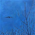
I saw a lot of animals yesterday. The day had started with several vultures circling overhead which is exciting if cliched. Apart from crows and sparrows I recognised no more of the plenty of birds I saw. Lots of flashes of colour, of white, black, grey, and particularly blue. I looked through a bird book of California later in the day but it merely asked more questions than it answered. A jack rabbit, some prairie dogs, a tarantula, and I was told there’s a mountain lion around here.
The route I was following was one used by what now seems like a host of old friends: The early Spanish explorers; Kit Carson leading General Kearny’s army; the Mormon Battalion on its way to the Mexican American War; Sonoran gold seekers; the first transcontinental mail service; and the Butterfield overland stage as it made its way from Tipton, Missouri to San Francisco.
The Vallecito Stage station was built in 1852 and restored in 1934. A newspaperman on the Butterfield stage wrote in 1858 “Vallecito, or little valley, is a beautiful green spot - a perfect oasis in the desert; it is about 5 miles square, surrounded by rugged timberless hills, and the green bushes and grass are most refreshing relief from the sandy sameness of the desert.” I felt the opposite. When I saw its greenness I was disappointed. Drunk on the beauty of the desert I wanted no interruption.
My stomach cramps were now so bad I needed to stop but time was against me if I was to make it to Julian before sunset. The lady in the shop at Agua Caliente had confirmed there was nowhere to stay before then. I lay down beside the historical panel for the San Diego mail route - about 8 miles further up the road. The sight of the tiny little yellow and green leaves against the blue sky had me thinking this would do as a bed for the night. Was the sky ever more blue?
It was from this point that the mail line from San Antonio, Texas, departed from the main route and ventured west over the mountains to San Diego, while the Emigrant Trail continued north. This was James Birch’s mail line and it lasted less than 2 years succumbing to the faster Butterfield Stage. The first trip took 53 days and was driven by James E. Mason after whom the valley was named.
I climbed up into Box Canyon. Here you can clearly see where Lt. Col. Philip St. George Cook’s Mormon Battalion had carved a gap wide enough for their wagons to pass through. The road then dropped by Blair Valley and I stopped at Shelter Valley for something for my stomach. Robert and Michelle had just bought the campground / RV park 3 days ago and said I could stay in the overnight trailer. So I have a huge campsite all to myself. I’ve 15 miles to Julian of which the last 8 is the big climb and then it’s another 60 to the coast. Nervous and excited I should clean up and go.
As ever in the desert fighter jets scream overhead. The sun, I watched rise and paint the surrounding mountains various colours. I can hear birds all around. The greater valley is called Earthquake Valley with the Pinyon Mountains to the north and Granite Mountain behind me to the south. In a few miles I reach Scissors Crossing, then it’s a gradual climb through the Cigarette Hills to the bottom of Banner Grade. I’ve been told the Grade has more bends in an 8 mile stretch of highway in all of North America, but I don’t believe that. The same person told me all the women in Boston were ugly.
I’ll have to do some talking in Julian as I have a choice of 2 routes.
It’s hard to know what to think. Is this really the last day? Should I think big thoughts, important thoughts? Or is it just another small day, of which the small thoughts and the frivolity are the essential constituent parts of the overall trip? I don’t know. I do know there’s so much practicalities to deal with I have not the time to dwell and to wonder, but I do think I know why Americans don’t put contours on maps.
- They’re not straight.
California is full of designated areas like this desert. There are Indian reservations, state forests, state parks, national forests, naval air stations etc. All of them have straight edges, and mostly north to south or east to west straight. They’re very reluctant to even use diagonal straight borders. So how could they possibly represent contours - they’re natural, curved, they upset the format America has tried to impose upon the landscape so they simply pretend they don’t exist. It’s a wonder they bother with the coast.
One more day. Just one. It’s almost over. Even if something goes wrong I can make it the next day (excepting the expected pedal break). Julian by 11 and then one more climb. I’ll still be fighting the sunset. I’m looking forward to this. One more effort, one more day. Blue sky, mountains, desert, will I see the ocean?
Read the Next Entry (#82) in My Bicycle Trip Across America
Read the Previous Entry (#80) in My Bicycle Trip Across America
Read more from my Cycle Across America
The excerpts forming Part 81 were written in Shelter Valley, California at 6 a.m. on November 19, 1996.

 Eolaí gan Fhéile: